Looking for a new place to hike, run, or cycle? Whether you have recently moved to a new area, are traveling, or simply seeking new scenery, the list of sites and apps to direct you to nearby trails can be overwhelming. We’ve narrowed the list to include our favorites.
1. Hiking Project [Best Overall for Finding Hiking Trails]
Hiking Project is a site put together by the outdoor retailer REI Co-op. It has an active user base which helps gain an understanding of trail conditions. It is one of the few sites that include international hiking trails and does not pester you with paywalls and login requests. You can filter hikes for pertinent information such as trail difficulty, distance, dog-friendly, and scenery. The site also features Top Rated Hikes based on user feedback.
Mobile App: Yes
Region: World
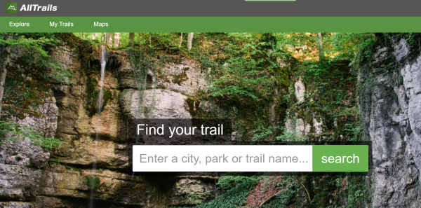
2. AllTrails [Best for Checking Crowds/Conditions on Hiking Trails]
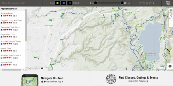
AllTrails is a comprehensive site that allows you to search for trails based on your location and filter the search results using options such as trail difficulty, activity type (i.e., hiking, cycling, kayaking, birding, etc. ), trail length, dog-friendliness, and more. You will need to create a login to view details and directions. Alltrails is the most widely used site (and app) for finding and reviewing trails in the USA. Due to its popularity, many users submit trail reviews and report trail conditions. Due to its popularity with the masses, we like to use it to determine if/when a trail might be crowded and view current conditions based on the sheer volume of user-submitted reviews.
Inexperienced hikers should closely examine any routes that are minimally rated or unrated on this app in closer detail on a map. Because the app is crowdsourced, users can submit hikes that will route to dangerous cliffs, water crossings, or traverse sensitive wilderness areas. For this reason, we recommend you always scrutinize any minimally rated trails in Alltrails.
Printed hiking maps can be found online or downloaded to your phone using Avenza Maps, a fantastic resource for downloading free and paid maps.
Mobile App: Yes
Region: World
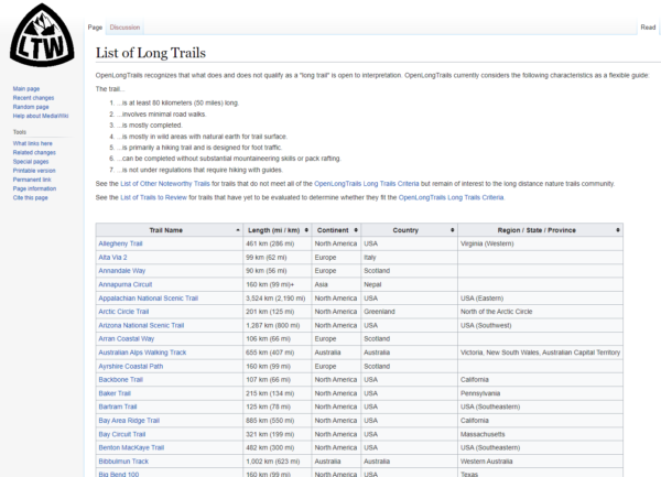
3. Open Long Trails [Best for Finding Long-Distance/Multi-Day Hiking Trails]
OpenLongTrails (OLT) is a work-in-progress repository focused solely on worldwide long-distance hiking trails. Created by thru-hiker, numbers, the project’s goal is to freely link helpful info, such as maps, GPS downloads, and weather data, in one place using open-source principles. The wiki makes it easy to research trails by region. See how you can contribute to this project at OpenLongTrails.org FAQ.
Mobile App: No
Region: Worldwide
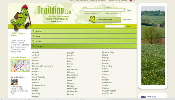
Like OpenLongTrails (OLT), Trail Dino is another massive database of trails worldwide, making it a fantastic starting point for discovering new hiking trails in unfamiliar areas. We like the visual interface for researching routes by country and drilling down to a local destination. The site contains helpful links to other pages so you can view trip reports, trail journals, maps, and more, although some of the content is outdated.
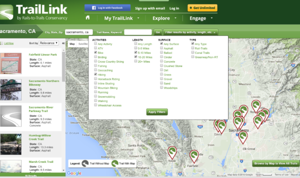
4. Trail Link [Best for Finding Bike Trails]
TrailLink is a project of the Rails-to-Trails Conservancy, a U.S.-based organization that converts unused railroad tracks to multi-use trails primarily intended for cycling rather than hiking. Many of these trails are paved near major cities, which means they are excellent for bike commuting. Of course, they are also great for recreational cycling and walking. This resource helps find longer off-road cycle routes in remote areas that you can then use to connect to lesser traveled roads. We are big fans of the Rails-to-Trails Conservancy.
Mobile App: Yes
Region: USA
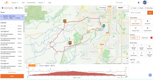
5. Ride with GPS [Best for Finding BikePacking Routes]
Ride with GPS is the best bikepacking planning tool for finding routes using official and unofficial bike trails, dirt roads, and single-track. It works well for both planning (you can draw routes) and navigation (save GPS as a GPX file to your phone/device). The paid version includes offline route navigation.
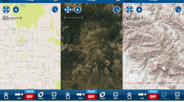
6. Backcountry Navigator XE [Best Hiking GPS app]
We’ve tested many GPS trail apps and think this one is the best. The app links to various topographic (topo) maps, and you can download the map offline to your phone/device. You can draw your desired trip on the map, save it to your device, and use the map to navigate by following the GPS waypoints while on the trail. Because the app uses GPS, you don’t need a cell signal and can run your phone with the data turned off (a huge battery saver on the trail). You can also record your hikes, and it will keep this info offline so you can view it later when you get a home/internet connection. The site also allows you to download treks posted by other users.
Mobile App: Yes
Region: USA-focused, but quickly expanding Worldwide
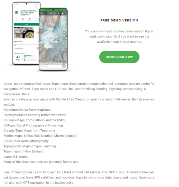 | 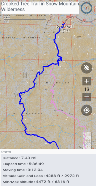 Example of a saved hike using the backcountry navigator app |
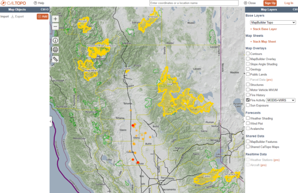
7. Caltopo [Best for Viewing Fire Activity]
Hiking in the Western U.S.? With the unfortunate increase in wildfires across the region, always check ahead for current and past fire activity. CalTopo’s Fire Activity overlay is the most detailed we’ve found for finding active fires, aggregating data from several sources, including MODIS, VIIRS, and GOES satellite platforms, as well as the National Interagency Fire Center. Keep in mind that because Caltopo uses satellite sources to report infrared data, you will also see non-fire activity coming from heat sources emanating from power plants and factories. While these maps provide valuable insights into areas impacted by fire, the data can be delayed or erroneous. Also, since the data is updated in real-time, it doesn’t represent where the fire is on the ground. When there is nearby fire activity, we recommend checking the air quality and contacting the associated federal lands agency for current information. Four agencies administer nearly all U.S. public lands: National Park Service, United States Forest Service, Bureau of Land Management, and U.S. Fish & Wildlife Service. We recommend the interactive U.S. Geological Survey Map Viewer or ArcGIS – USA Federal Lands to find out who to contact.
Google Earth [Best for Viewing Satellite Images in Detail on a Computer]
Google Earth requires some skill to use, and it involves a lot of bandwidth; however, if you enjoy viewing maps at home in minute detail, install Google Earth on your computer or phone. Google Earth uses a combination of satellite images and user-submitted photos for navigation. Start by searching an area you are familiar with to get a feel for how the software works. To view major U.S. hiking trails, click on the Layer “More” ->Parks, Recreation Areas-> U.S. National Parks->Trails.
Use the Voyager layer to see where Google Earth has 3D imagery. Maps 3D (App for iOS) is another tool we recommend if you want a visual 3d view of the topography of a trail. It will give you a greater appreciation of the peaks and valleys you will be climbing and descending.